Mount Leinster Hike Full Guide: Route, Views and Tips
Mount Leinster stands proudly within the scenic Blackstairs Mountains and marks the highest mountain across County Carlow and County Wexford. The Mount Leinster hike attracts walkers, hikers, and families seeking rewarding views without committing to long mountain routes.
A well maintained access road leads from Nine Stones viewing point directly toward the mountain’s summit transmitter. Although short, the trail includes steep gradients that challenge hikers while remaining accessible to most reasonably fit visitors.
Many families enjoy the walk because the route is straightforward and navigation remains simple throughout the climb. On clear days, the summit reveals wide views across countryside landscapes stretching toward the distant Wexford coastline.
This guide explains Mount Leinster’s location, hiking routes, difficulty level, summit views, and nearby places worth exploring.
Where Is Mount Leinster?
Mount Leinster sits on the border between County Carlow and County Wexford in southeastern Ireland. The mountain forms part of the Blackstairs Mountains, a long ridge that stretches along the Carlow and Wexford boundary.
Its summit reaches 795 metres above sea level, making it the highest peak in both counties.
The mountain stands about thirty minutes’ drive from the town of Enniscorthy in County Wexford. Visitors travelling from Kilkenny City can reach the trailhead in approximately forty five minutes by car.
Graiguenamanagh village lies about twenty five minutes away and offers scenic riverside views along the River Barrow.
Many walkers begin their journey at Nine Stones viewing point, a scenic roadside stop below the summit. This location already provides sweeping countryside views before hikers start the climb toward Mount Leinster’s summit.
Quick Facts About Mount Leinster
Below are some quick facts about Mount Leinster.
Mount Leinster height: The summit reaches approximately 795 metres above sea level, placing it among the notable highest mountains in Ireland.
County: The mountain sits between County Carlow and County Wexford.
Mountain range: Mount Leinster forms part of the Blackstairs Mountains.
Difficulty: The hike is short but includes steep gradients that require moderate fitness.
Distance: The most common route measures roughly three kilometres return from Nine Stones.
Starting point: Most hikers begin at Nine Stones viewing point below the summit access road.
Best season: Clear days in spring, summer, and early autumn provide the best hiking conditions.
Mount Leinster Hike Overview
The Mount Leinster hike offers a straightforward route to one of the highest viewpoints in southeastern Ireland. Most visitors follow the direct trail beginning at the Nine Stones viewing point car park.
From here, hikers walk along a tarmac access road leading toward the summit transmission mast.
The total Mount Leinster walk distance measures roughly three kilometres for a return journey. Despite the short distance, hikers gain approximately 350 metres of elevation during the climb.
The route gradually ascends through bends before revealing wider views across the surrounding countryside.
Because the road remains clearly defined, navigation stays simple even for hikers unfamiliar with mountain trails.
This accessibility makes the mountain popular with families and casual walkers. Many visitors consider it one of the best hikes in Ireland for beginners seeking panoramic views.

Mount Leinster Route From Nine Stones
Below you will find the complete route details for Mount Leinster from Nine Stones.
Starting at Nine Stones Viewing Point
Most hikers start the Mount Leinster route at Nine Stones viewing point along the L3005 mountain road. This scenic viewpoint includes a small car park that can fill quickly during clear weekends and holidays.
The walk begins beside metal barriers that mark the start of the tarmac road leading uphill.
Even before beginning the climb, hikers can enjoy wide views across valleys and farmland below.
The Steep Climb
Soon after starting, the road climbs steadily while passing wooded areas and grazing fields nearby.
Gradients can reach around twenty percent in places, creating the most physically demanding section of the hike. Although challenging, the smooth road surface makes walking easier compared with rocky mountain trails.
As the climb continues, the surrounding trees gradually disappear and wider landscapes across the Blackstairs range come into view.
Reaching the Summit
Eventually the tall transmitter mast appears ahead and clearly marks the Mount Leinster summit area.
A trig point and stone cairn sit near the summit and provide a popular photo location.
Despite limited shelter near the top, the summit rewards hikers with sweeping views across southeastern Ireland.
Mount Leinster Loop Walk Alternative Route
The Mount Leinster loop walk provides a longer and more varied alternative to the direct road route.
This trail measures roughly eight kilometres and passes through forestry tracks and open mountain terrain.
Walkers follow gravel paths alongside woodland before eventually joining the summit access road higher up.
Compared with the shorter route, the loop offers quieter surroundings and more natural trail scenery similar to routes found along the Wicklow Way.
However, the longer distance and uneven terrain require stronger fitness levels and careful route awareness.
How Difficult Is the Mount Leinster Hike?
The Mount Leinster hike difficulty is moderate despite the trail being relatively short. Most of the challenge comes from steep gradients along the tarmac road climb.
Hikers gain roughly 350 metres of elevation during the ascent toward the summit transmitter. People with average fitness can usually complete the climb comfortably with regular breaks.
However, windy conditions near the summit can increase the challenge and require extra preparation.
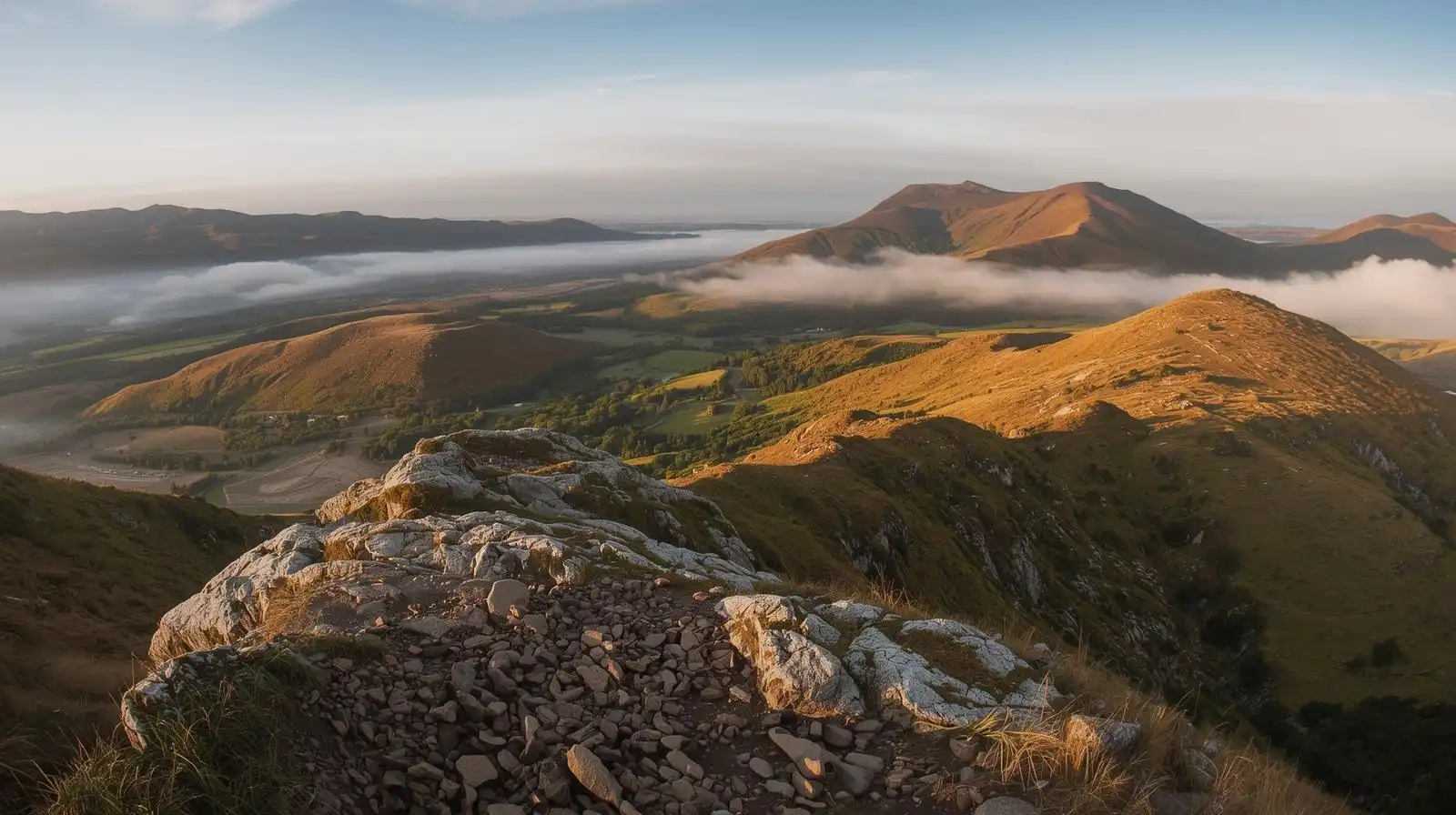
Views From the Mount Leinster Summit
The Mount Leinster summit views provide one of the most impressive panoramas across southeastern Ireland. On clear days, hikers can see farmland landscapes stretching across County Carlow and surrounding valleys.
The rolling peaks of the Blackstairs Mountains appear especially dramatic from the elevated viewpoint. Looking eastward, distant glimpses of the Wexford coastline sometimes appear on very clear days.
These sweeping views reward hikers who complete the steep climb toward Mount Leinster’s summit.

Tips for Hiking Mount Leinster Safely
1. Always check the weather forecast before starting your hike in the exposed Blackstairs Mountains.
2. Strong winds and fog often develop near the summit even during otherwise calm conditions.
3. Wear sturdy footwear because steep gradients can become slippery in wet or icy weather.
4. Carry warm layers because temperatures drop quickly at higher elevations.
5. Stay on the clearly visible access road if fog develops during the climb.
6. Follow Leave No Trace principles and respect the natural environment throughout your hike.
Things to Do Near Mount Leinster
Several attractions near Mount Leinster make it easy to combine hiking with sightseeing.
Huntington Castle and Gardens sits roughly twenty five minutes away and features beautiful historic grounds. Visitors interested in history and architecture often explore the castle before or after their mountain walk.
The riverside village of Graiguenamanagh offers cafés, pubs, and scenic walks along the River Barrow.
Another nearby hiking opportunity includes Mount Brandon in County Kilkenny, which is the highest mountain in that county. These nearby destinations help turn a simple hike into a full day exploring southeastern Ireland.

Conclusion
Mount Leinster remains one of the most accessible mountain hikes in southeastern Ireland. The trail combines a manageable distance with rewarding views across counties Carlow and Wexford.
Although steep in places, the clearly defined route allows walkers to reach impressive heights quickly. Families, casual hikers, and photographers often choose this mountain for its simplicity and panoramic scenery.
With proper preparation and favourable weather, the hike becomes a memorable outdoor adventure.


