

Ring of Kerry Itinerary Guide 2026: Best Stops, Map & Travel Tips
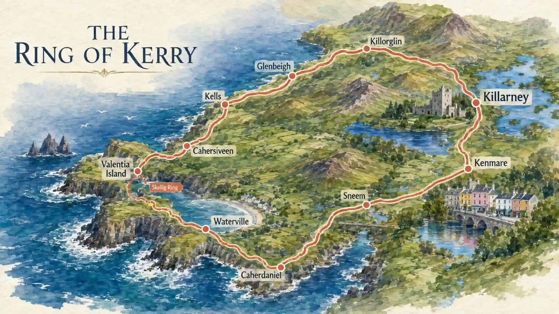
The Ring of Kerry is one of Ireland’s most spectacular scenic drives, looping for approximately 179 km (111 miles) around the Iveragh Peninsula in County Kerry. The route combines the Atlantic coastline, mountain passes, beaches, historic landmarks, colourful villages and some of the most dramatic scenery in southwest Ireland.
Most travellers begin and end in Killarney, making it an easy addition to an Ireland road trip. You can complete the circuit in a day if necessary, but allowing two days gives you much more time for beaches, viewpoints, walks, villages and detours.
This updated guide covers the best stops, how to plan your Ring of Kerry itinerary, which direction to drive, where to stay, whether you need one or two days, and how to add the Skellig Ring and Valentia Island.
Some Quick Need-to-Knows
The Ring of Kerry is one of Ireland’s best-known scenic drives, but a little preparation will make the experience much easier.
Where Does the Ring of Kerry Start and End?
Killarney is the most popular starting point because it offers plenty of accommodation, restaurants, transport connections, and easy access to Killarney National Park.
However, there is no fixed start or end point for the Ring of Kerry. It is a loop route, so you can begin and finish your trip in any town along the Iveragh Peninsula. You can also join the route from Kenmare, Sneem, Cahersiveen, Killorglin, or other towns along the peninsula.
How Long Is the Ring of Kerry?
The main Ring of Kerry circuit is approximately 179 km (111 miles) long.
Drive Times and Itinerary
- Non-stop driving time: Around 2.5 to 3.5 hours without stops, depending on traffic and road conditions.
- Recommended time: Allow at least 6 to 8 hours, or a full day, to account for narrow roads, scenic viewpoints, villages, and other stops along the route.
If you have more time, a 2-day Ring of Kerry itinerary allows you to explore the main sights at a more relaxed pace rather than rushing through the route in one day.
How Long Does the Drive Take?
You can technically drive the Ring of Kerry in one day, but the total time depends heavily on your starting point, stops, traffic, weather, and any detours along the way.
Main Factors That Affect Drive Time
- Traffic: Traffic can slow you down, particularly around Killarney and other busy areas during peak tourist season.
- Road conditions: Parts of the Ring of Kerry include narrow, winding roads where you will need to drive more slowly.
- Stops and sightseeing: Scenic viewpoints, beaches, villages, and attractions can add several hours to your journey.
- Weather: Rain, fog, wind, or poor visibility can make driving slower and require extra caution.
- Detours: Taking short detours to places such as Skellig Ring, Valentia Island, or Rossbeigh Beach will increase your overall driving time.
For a more relaxed experience, 6–8 hours is a reasonable minimum for the main loop with stops.
What Direction Should You Drive?
There is no mandatory direction for driving the Ring of Kerry, but many self-drive visitors choose to travel clockwise from Killarney.
One of the main reasons is that most large tour buses travel counter-clockwise around the route. Driving clockwise can therefore reduce the chances of meeting buses head-on, particularly on the narrow coastal sections of the road. It can also make the drive feel more relaxed, although you should still expect some traffic during the busy summer months.
What Is the Ring of Kerry Route?
The main route passes through a mix of mountain and coastal landscapes, linking popular towns and villages including Killarney, Kenmare, Sneem, Waterville, Cahersiveen, and Killorglin.
Along the way, you’ll find dramatic coastal views, sandy beaches, mountain passes, historic sites, and traditional villages. The route also connects with several worthwhile detours, including the Skellig Ring and Valentia Island, which can add extra scenery and attractions to your trip.
Route Details and Stops
- Main Circuit: The traditional route connects Killarney, Kenmare, Sneem, Waterville, Cahersiveen, and Killorglin before returning to Killarney.
- Scenic Detours: The Skellig Ring and Valentia Island are popular additions for travellers with extra time.
- Natural Highlights: Expect mountain scenery, rugged coastline, beaches, lakes, and scenic viewpoints throughout the peninsula.
- Historic Attractions: Notable stops include Ross Castle and Muckross House, while the Gap of Dunloe is a popular nearby detour from Killarney.
Can You Visit Without a Car?
Yes. Although driving is the most flexible way to explore the Ring of Kerry, you can experience the route without hiring a car. Guided tours, public transport, cycling, and walking all offer alternatives, depending on how much of the route you want to cover and how active you want your trip to be.
Best Ways to Travel Without a Car
- Guided Coach Tours: Regular tours from Killarney cover the main Ring of Kerry highlights, making them one of the easiest options for first-time visitors. You can enjoy the scenery and local commentary without having to navigate narrow, winding roads yourself.
- Public Transport: Bus services connect towns such as Killarney, Killorglin, Cahersiveen, and Waterville. However, services can be limited, so check timetables carefully and allow extra time when planning your journey.
- Cycling: Cycling the Ring of Kerry is a popular option for experienced cyclists. You can explore the peninsula at your own pace, although the route includes long distances, hills, and sections of narrow road, so it requires good fitness and careful planning.
- Walking and Hiking: The Kerry Way provides a different way to experience the region on foot. Rather than following the driving route exactly, this long-distance trail passes through mountains, countryside, villages, and coastal landscapes.
For most visitors without a car, a guided tour from Killarney is the simplest option. If you have several days and want to explore more independently, combining public transport with local tours, walking, or cycling can work well.
Ring of Kerry Map with Stops
A map is particularly useful when planning this trip because the main loop contains numerous side roads and attractions.
Google Map with Stops
Before leaving Killarney, save the attractions you want to visit and download offline maps if your phone supports them. Rural areas can have inconsistent mobile coverage, so relying entirely on live navigation is not ideal.
Useful stops to mark include:
- Killarney
- Killarney National Park
- Torc Waterfall
- Ladies View
- Moll’s Gap
- Kenmare
- Sneem
- Derrynane Beach
- Waterville
- Ballinskelligs
- Portmagee
- Kerry Cliffs
- Valentia Island
- Cahersiveen
- Glenbeigh
- Rossbeigh Beach
- Killorglin
Route Roads Explained
The route uses several roads rather than one single road from beginning to end.
The N71 takes you from Killarney towards Kenmare, passing through some of the mountain scenery associated with Moll’s Gap. The N70 continues around much of the coastal section towards Sneem, Waterville, Cahersiveen and the northern side of the peninsula.
Smaller roads branch off towards attractions and detours, including parts of the Skellig Ring and Valentia Island.
Landmarks to Watch For
Keep an eye out for signs directing you towards:
- Torc Waterfall
- Ladies View
- Moll’s Gap
- Derrynane House
- Derrynane Beach
- Kerry Cliffs
- Valentia Island
- Skellig Ring
- Killarney National Park
Many attractions have designated parking areas or lay-bys, but popular locations can become busy during peak periods.
Ring of Kerry Highlights and Stops
The best part of the journey is that the scenery changes constantly. Mountains give way to lakes, coastal roads open towards the Atlantic, and small villages appear between stretches of countryside.
Natural Highlights
Killarney National Park
Start your journey with Killarney National Park, which covers around 10,000 acres of lakes, woodland and mountains. The park is home to attractions including Muckross House and offers opportunities for walking, cycling, jaunting-car rides and exploring the Lakes of Killarney.
Torc Waterfall
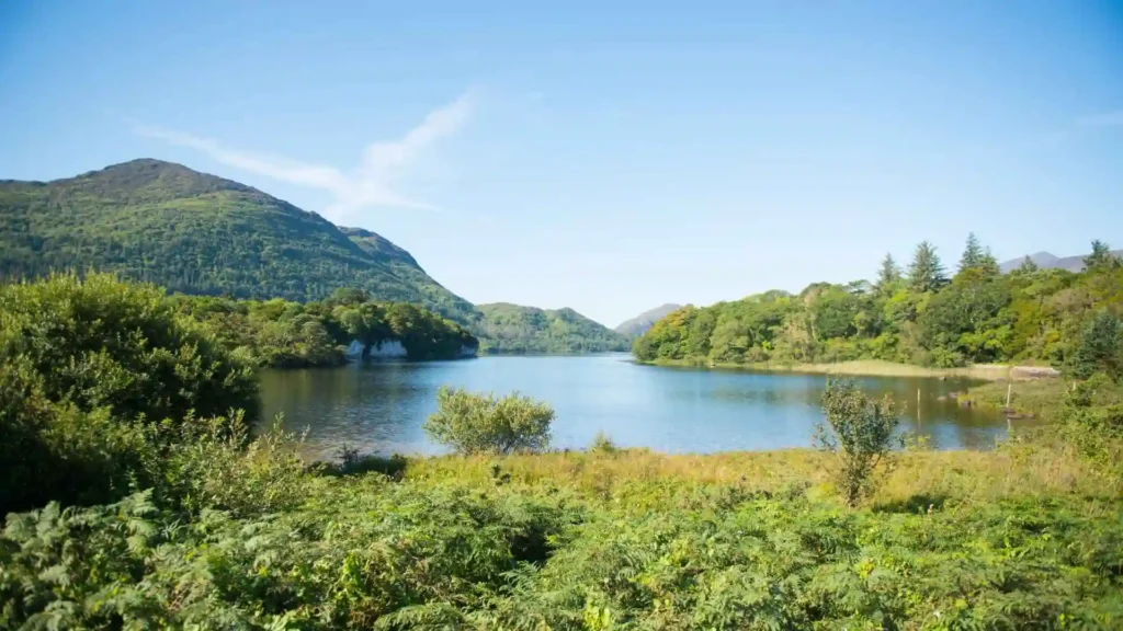
Torc Waterfall is one of the easiest scenic stops to add near Killarney. It is around 7 km from Killarney town centre and can be reached via a short walk from the nearby car park. Arriving earlier in the day can make parking easier.
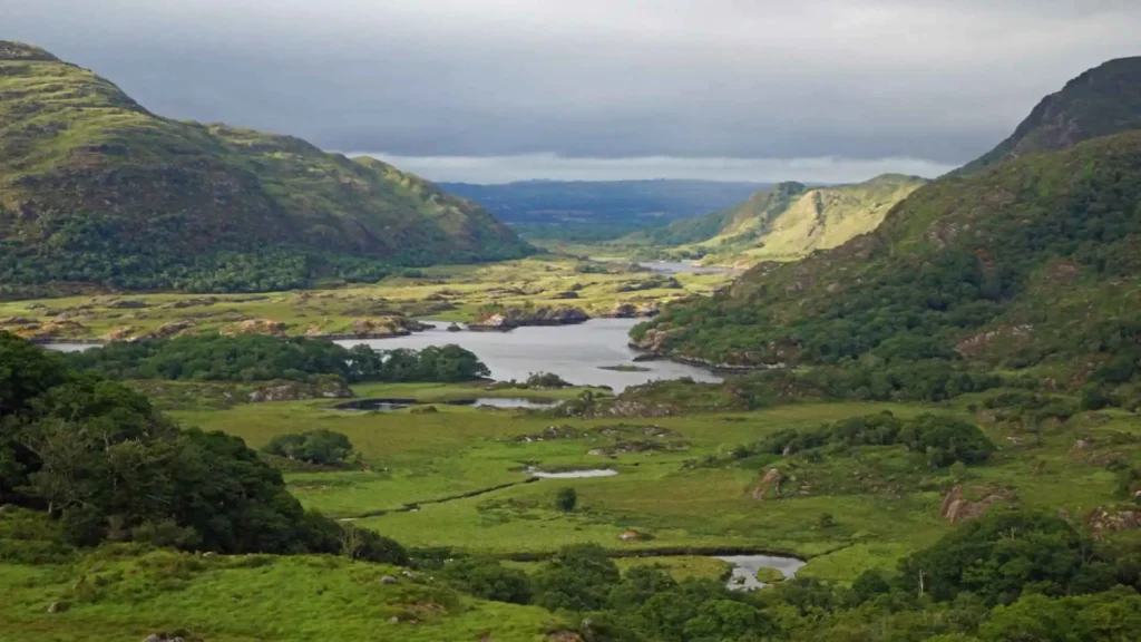
Ladies View
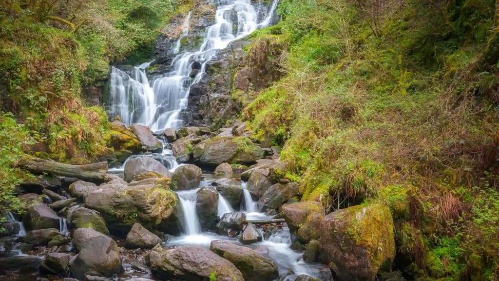
Located along the route between Killarney and Kenmare, Ladies View provides a panoramic outlook over the lakes and mountains of Killarney. The viewpoint takes its name from Queen Victoria’s ladies-in-waiting, who admired the scenery during their 1861 visit to the area.
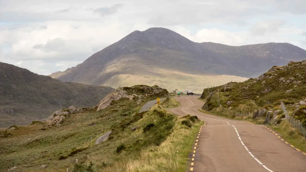
Moll’s Gap
Moll’s Gap is another major scenic stop, with expansive views across the mountainous landscape of the Iveragh Peninsula. It is particularly worthwhile when travelling between Killarney and Kenmare.
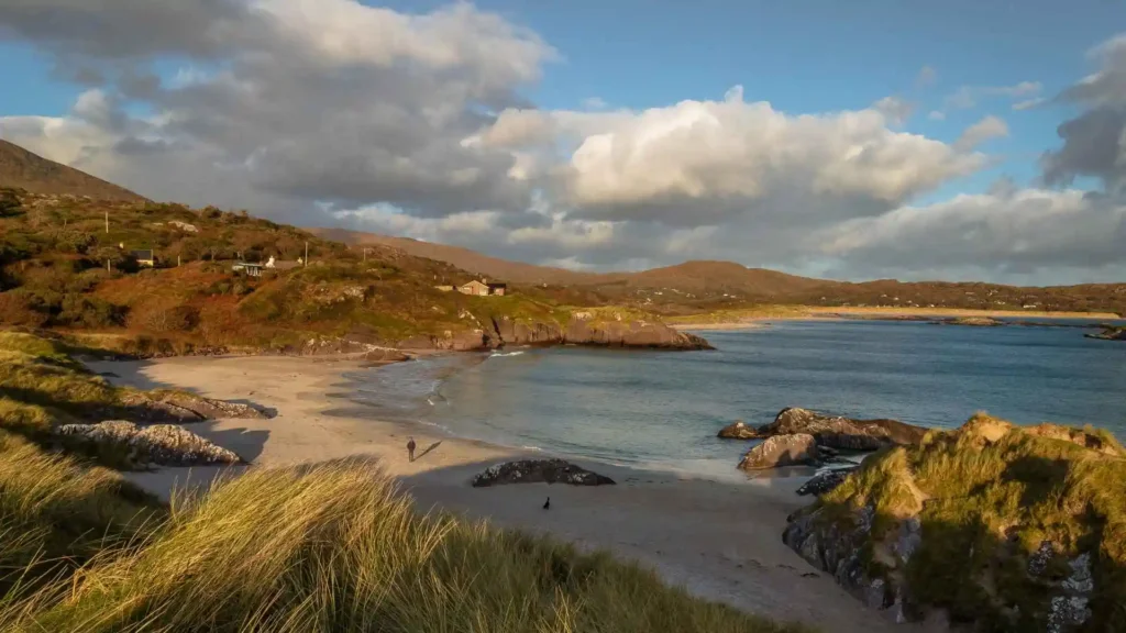
Derrynane Beach
Derrynane is one of the route’s standout coastal stops. Its sandy shoreline and Atlantic setting make it a good place to slow down after several hours of driving.
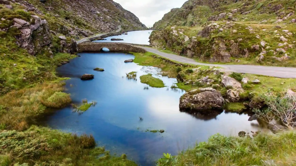
Gap of Dunloe
If you have additional time around Killarney, consider adding the Gap of Dunloe. The dramatic mountain pass can be explored on foot, by bicycle or by traditional jaunting car. It works better as a dedicated excursion than as a rushed roadside stop.
Historic and Cultural Highlights
Ross Castle
Ross Castle sits on the shores of Lough Leane in Killarney National Park and is an excellent addition before beginning the longer coastal section of the journey.
Muckross House and Gardens
Muckross House is a 19th-century mansion within Killarney National Park. Its gardens and surrounding landscape make it particularly worthwhile for travellers who want more than a quick viewpoint.
Staigue Stone Fort
Staigue Fort is an impressive dry-stone fort dating from Ireland’s early historic period. Its thick circular walls provide a striking example of traditional stone construction.
Derrynane House
Near Caherdaniel, Derrynane House was the home of Daniel O’Connell, an important figure in Irish political history. Visitors can explore the historic house and surrounding grounds.
Skellig Michael
Off the coast lies Skellig Michael, a UNESCO World Heritage Site famous for its early medieval monastic settlement. The island is also widely recognised for its appearance in the Star Wars films.
Boat trips are seasonal and weather dependent, so anyone hoping to land on the island should plan ahead rather than treating it as a guaranteed stop.
Towns and Villages Worth Exploring
The towns along the route are part of the experience rather than simply places to refuel.
Killarney is the most convenient base for many visitors, with extensive accommodation, restaurants and access to the national park.
Kenmare is known for its colourful streets, restaurants and relaxed atmosphere and makes a good overnight base.
Sneem is a small, colourful village that works well for a coffee, lunch or short walk.
Waterville sits beside the Atlantic and is particularly associated with Charlie Chaplin, who regularly visited the town.
Cahersiveen is a useful base for exploring the northern section of the peninsula and nearby historical attractions.
Glenbeigh provides access to Rossbeigh Beach and is another option for an overnight stay.
Killorglin is known for its historic Puck Fair and provides a convenient connection back towards Killarney.
One-Day Ring of Kerry Itinerary
If you have only one day, focus on the classic highlights rather than trying to visit every attraction.
Morning: Killarney to Kenmare
Start early in Killarney.
Visit:
- Ross Castle
- Muckross House or Muckross Abbey
- Torc Waterfall
- Ladies View
- Moll’s Gap
Continue towards Kenmare for coffee or an early lunch.
Afternoon: Kenmare to Waterville
After Kenmare, continue towards Sneem and then head towards the southern and western coastline.
Consider stopping at:
- Sneem
- Derrynane Beach
- Derrynane House
- Coomakista Pass
- Waterville
You do not need to stop at every location. Choose the attractions that best match your interests and leave enough time for the return journey.
Evening: Waterville to Killarney
From Waterville, continue towards Cahersiveen and the northern side of the peninsula before heading through Glenbeigh and Killorglin towards Killarney.
A one-day itinerary is possible, but it is a full day. If you want substantial hiking, longer beach visits or multiple historic attractions, two days will be more enjoyable.
Timing and Logistics
Start early, especially during busy travel periods.
Instead of giving every stop an identical time allowance, plan your day around a few major attractions and leave additional flexibility for viewpoints, photographs, meals and unexpected delays.
Two-Day Itinerary
A two-day Ring of Kerry road trip gives you considerably more breathing room.
Day 1 – Killarney, Kenmare and the Southern Coast
Start in Killarney and explore:
- Killarney National Park
- Ross Castle
- Muckross House
- Torc Waterfall
- Ladies View
- Moll’s Gap
- Kenmare
- Sneem
- Derrynane Beach
Stay overnight in Kenmare, Sneem, Waterville or another convenient coastal location.
Day 2 – Western Coast and Northern Loop
Continue west towards:
- Waterville
- Ballinskelligs
- Portmagee
- Kerry Cliffs
- Valentia Island
- Cahersiveen
- Glenbeigh
- Rossbeigh Beach
- Killorglin
Return to Killarney in the evening or stay another night if you want an even slower itinerary.
Skellig Ring and Valentia Island Detour
The Skellig Ring is one of the most rewarding additions to the main circuit if you have enough time.
This coastal detour around the western side of the Iveragh Peninsula provides access to dramatic Atlantic scenery and views towards the Skellig Islands.
What to See
Key stops include:
- Kerry Cliffs
- Portmagee
- Ballinskelligs
- Ballinskelligs Beach
- Skellig Experience Centre
- Valentia Island
- Geokaun Mountain
- Valentia Lighthouse
The Kerry Cliffs are particularly dramatic. They rise more than 1,000 feet above the Atlantic and provide views towards the Skellig Islands and Puffin Island. They are located around 3 km from Portmagee.
Valentia Island can also be reached by ferry from Knightstown during its seasonal operating period, or by returning through Portmagee and continuing on the mainland route. Check current ferry arrangements before travelling because schedules can change.
If you are short on time, do not add every detour simply to tick them off. The Skellig Ring is best enjoyed when you can stop and appreciate the coastline.
Travel Tips for Driving the Ring of Kerry
Keep these practical points in mind:
- Start early: Popular viewpoints and attractions become busier later in the day.
- Drive carefully: Some rural roads are narrow, winding and exposed.
- Allow extra time: Photographs, viewpoints, sheep crossings, traffic and weather can all slow the journey.
- Fuel up: Fill the tank in larger towns rather than assuming a petrol station will be available at your next stop.
- Download maps: Offline navigation is useful in rural areas.
- Check the weather: Conditions can change quickly along the exposed Atlantic coast.
- Pack layers: Even during warmer months, coastal and mountain areas can feel considerably cooler.
- Respect wildlife: Sheep and other animals can appear unexpectedly on rural roads.
- Book popular attractions ahead: This is especially important for seasonal boat trips and limited-capacity experiences.
- Do not rush: The route is about experiencing Kerry’s landscape, not simply completing a loop.
Where to Eat Along the Ring of Kerry
Food stops are easy to incorporate into the journey, particularly in larger towns.
Kenmare is one of the strongest choices for restaurants, cafés and evening dining.
Sneem is convenient for a lighter lunch or coffee break.
Waterville is a good place to stop for food while enjoying the Atlantic setting.
Cahersiveen provides additional options before the northern section of the route.
For a more relaxed experience, pick up local food and have a picnic at an appropriate viewpoint or beach. Always follow local guidance and take rubbish with you.
Where to Stay
Your choice of overnight base depends on how much of the route you want to explore.
Killarney
Best for first-time visitors who want easy access to Killarney National Park, restaurants and a large range of accommodation.
Kenmare
A strong choice for travellers who want to split the southern section of the route over two days while staying in a lively town.
Sneem
A quieter alternative for travellers who prefer a smaller village atmosphere.
Waterville
Ideal for travellers who want to stay close to the Atlantic coastline and western section of the route.
Cahersiveen
A practical base for exploring the Skellig Coast, Valentia Island and the northern side of the peninsula.
If you prefer a nature-focused stay, there are also hotels, guesthouses, B&Bs, self-catering properties and glamping options throughout County Kerry.
Final Thoughts
The Ring of Kerry is more than a scenic drive around County Kerry. It is a journey through mountain passes, Atlantic coastline, historic sites, beaches and welcoming towns across the Iveragh Peninsula.
A one-day trip works when time is limited, but two days allow you to slow down and include places such as the Skellig Ring, Valentia Island and the quieter coastal sections.
Plan your major stops in advance, leave room for spontaneous viewpoints and allow the weather and road conditions to shape your day. That is the best way to experience one of Ireland’s most memorable road trips.