Slieve Gullion | The legendary mountain with a bizarre curse
According to legends, a person who walks up Ireland’s most mysterious mountain will have white hair the next day, but the simple question is to figure out which trail matches your boots.
From a laid-back afternoon walk through the forest to a strenuous ascent of a moorland peak, discovering reliable information that distinguishes between the easy forest strolls and the wild boggy summits can be a baffling task.
This article contains all the information you need to know to plan your ideal trip to Slieve Gullion. You will find the exact parking instructions, trail hazards, and a clear description of where the easy family trail ends and the tough mountain trail begins.
The mountain
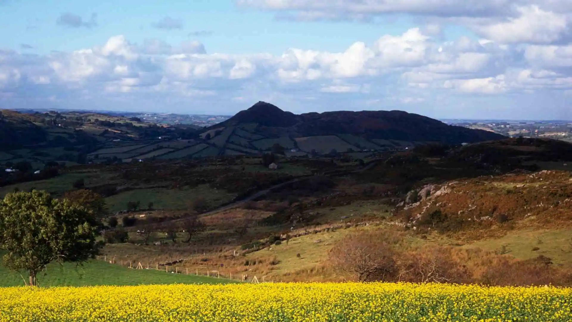
Slieve Gullion is 573 metres high and is the highest point in County Armagh and is a much-sought-after 32-county high point.
Geologically, it is the dramatic focus of a world-famous, south-western ring dyke system created millions of years ago when an ancient volcano collapsed.
The local folklore and Irish mythology are very much linked to the landscape. It is known as the land of the hunting grounds of the warrior-giant Finn McCool, the Cailleach Bhéara (the Cailleach of the Sea) and the home of the Winter Witch.
Getting there and the one-way system
The mountain is conveniently close to the main road between Dublin and Belfast and is a perfect place to stay overnight or for a day trip.
The walk begins at the main gates of Slieve Gullion Forest Park, which are marked with signs.
Make sure to listen to a serious warning about the upper mountain drive: It is a one-way street, and it is very narrow. Avoid missing the entrance to the upper Forest Park car park or the bays leading to the head of the mountain track, or you will need to make the full 8-mile drive all over again.
Choosing your walking route
The trail system is clearly divided into two experiences for different fitness and equipment levels.

The family walk and the viewing platform
A gentle rise towards the bottom of the slope provides an easy, accessible stroll through a handsome deciduous woodland.
The path is wide, well-maintained, and tarmacked and is ideal for walking with a buggy or with a toddler in a baby carrier.
The trail goes straight to a wooden viewing platform offering splendid views across the valley. As livestock are raised locally, strict sheep safety rules are in place, and sheep safety signage is used to remind visitors to keep all dogs on a lead.
The transition trap: Moving to the Strenuous 16km Circuit
Safety Alert: The smooth gravel trail abruptly terminates at the upper mountain gate. This is precisely where walkers should backtrack, as the trail becomes a wild, off-the-beaten-path hike.
Beyond this gate, the Slieve Gullion mountain walk takes a sharp turn up the rough north side.
Wear sturdy boots or tough hiking boots with ankle support to get through the varying terrain.
The track soon becomes bare rock and furrows, which become extremely muddy. It is also very important for hikers to be vigilant on the broad summit plateau, as a number of rolling false summits are constantly foiling the unwary hiker.
Summit: Tomb and Calliagh Berra’s Lough
If you reach the real highest point, you will be at one of the most historic Ulster high points.
Here, you will find a large cairn which completely covers the world-famous Slieve Gullion passage grave/tomb, a Neolithic passage tomb dating back over 5000 years!

A small, dark lake (Calliagh Berra’s Lough) lies just beyond the tomb, connected to a nearby Bronze Age burial chamber. Mountain conditions are often variable, so it is a good idea to bring a map and compass just in case low mist rolls over the top of the mountain.
Back to the road
Making a loop around the South Cairn area is the way to return uphill and head back down the open mountain.
The wooden waymarkers marking the edge of the Ring of Gullion Way should be looked out for.
After these markers, the track widens through the forest, completely missing the steep crags of the north face, and leads back to the lower park fields.
Completing the Slieve Gullion Loop
The completion of the whole Slieve Gullion Loop brings you back to fantastic panoramic views which stretch out through greener fields to the coastline of Co. Down.
The total distance walked will vary from one walk to another depending on where you start, so this could be a short 3km circuit through the forests or a longer 15km mountain walk, depending.
Remember to record the time at the end of your walk, enjoy a hot beverage at the courtyard café and check one of Ireland’s oldest peaks off your list.


