Bray Head Cross Walk Guide, Route, History and Summit Views
Bray Head Cross is one of the most recognisable landmarks in County Wicklow. It sits high above the coastal towns of Bray and Greystones. From the summit, hikers get wide views across the Irish Sea and the surrounding Wicklow landscape.
The walk is popular with both locals and visitors because it offers a proper hill climb without taking an entire day. Many people visit for a quick morning hike or to capture coastal views. The trail delivers a rewarding viewpoint within a short distance.
Bray Head Cross Quick Facts
- Location: Bray, County Wicklow, Ireland.
- Height: 191 metres (627 feet).
- Walking distance: 2.5 to 3 km depending on the route.
- Average time: 45 to 60 minutes to reach the summit.
- Difficulty: Moderate. Some sections are steep and rocky.
- Best time to visit: Early morning for sunrise views or weekday afternoons for clearer trails.
Where Is Bray Head Cross?
Bray Head Cross stands on Bray Head, a coastal hill on the northern edge of the Wicklow Mountains. It overlooks the seaside town of Bray and forms a natural boundary with the nearby town of Greystones.
The summit sits about 20 km south of Dublin, which makes it one of the closest hill walks to the capital. Bray Head is formed mainly of quartzite and slate, rising sharply above the Irish Sea. Its exposed position provides sweeping views across the Wicklow coastline and Dublin Bay.
History of Bray Head Cross
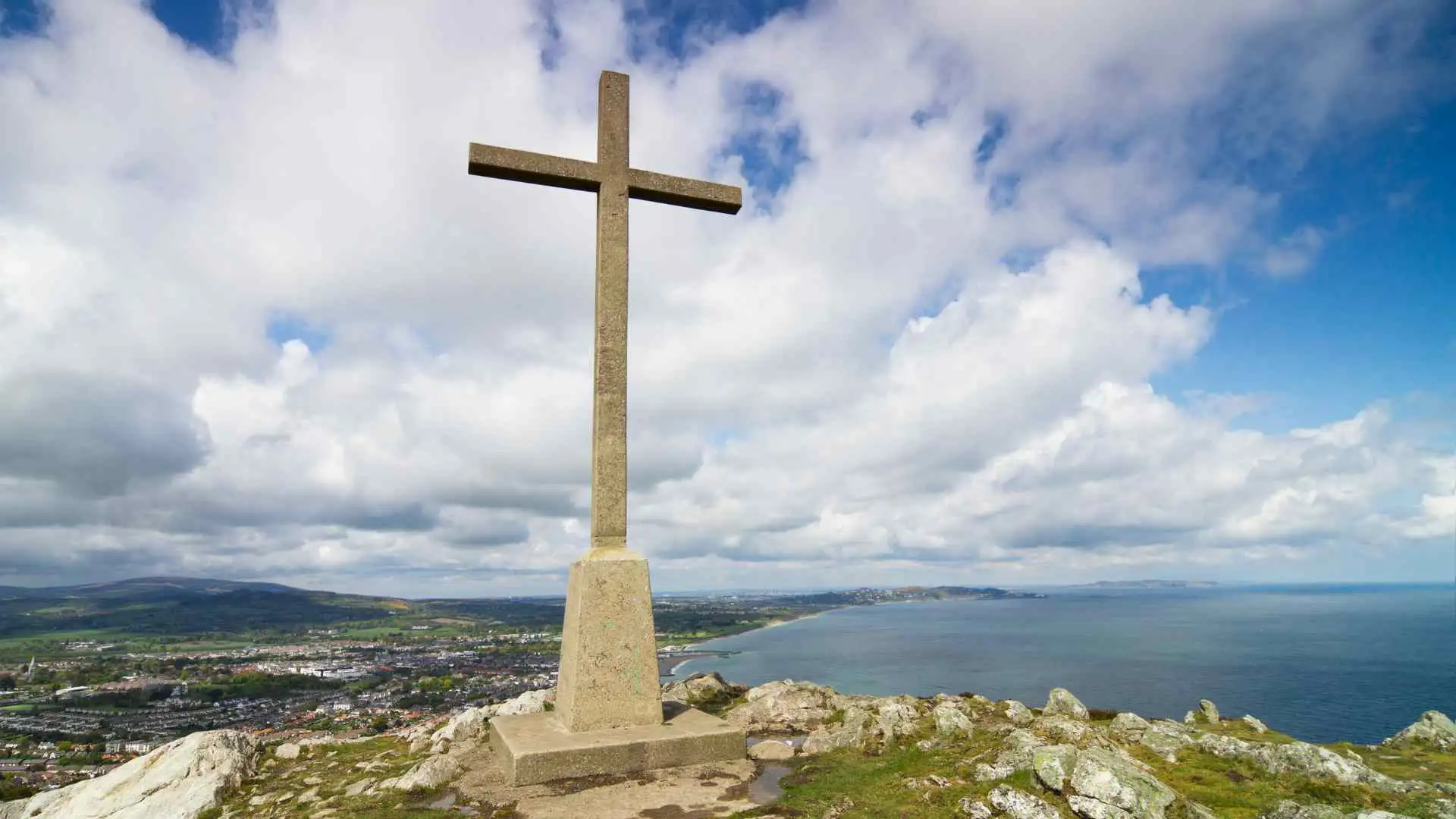
The large concrete cross was erected in 1950 on the summit of Bray Head to mark the Catholic Holy Year. The structure quickly became a symbol of the town and remains one of the most recognised landmarks along the Wicklow coast.
Every Good Friday, a traditional pilgrimage walk takes place from Bray to the summit. Participants climb the hill to attend a short religious service beside the cross. This tradition has continued for decades and remains an important part of local heritage.
How to Get to Bray Head Cross?
The most common starting point is the southern end of Bray Promenade. From here, walkers follow the paved path towards the Bray to Greystones Cliff Walk.
If you are driving, there is limited parking near the start of the Cliff Walk close to Bray seafront. Spaces fill quickly during warm weekends and holiday periods.
Public transport is very convenient. Take the southbound train on the Dublin Area Rapid Transit service to Bray Station. From the station, it takes about 15 minutes to walk along the seafront to reach the trailhead.
Some hikers also begin from the Greystones side using the Windgates entrance. This route is quieter but offers limited parking.
Bray Head Cross Walk Route Explained
Most hikers follow a direct route from Bray Promenade.
- The start: Begin at Bray Promenade and walk towards the entrance of the Bray to Greystones Cliff Walk.
- The ascent: After a short distance along the Cliff Walk, you will see steps and a dirt path climbing uphill through a metal gate.
- The steep section: The middle part of the trail becomes steep. Loose stones and soil can make the ground slippery, so take your time.
- The summit push: Near the top the trail becomes rockier. Short scrambles over larger rocks lead towards the summit plateau.
- The cross: Once you reach the top, a short flat section leads directly to the base of Bray Head Cross.
After rain the ground can become slippery, so sturdy footwear is important. The average walking time from the promenade to the summit is about 40 minutes at a steady pace.
Bray Head Loop Walk Alternative Route
If you want to extend the walk, you can continue along the Bray Head Loop. This trail follows the ridge south beyond the cross.

The full loop is around 5 to 6 km and offers a quieter experience away from the main summit path. Eventually the trail reconnects with the Bray to Greystones Cliff Walk. From there you can return towards Bray while enjoying views over the Irish Sea.
Views from Bray Head Cross
The summit offers wide coastal views in every direction. To the north you can see across Dublin Bay and, on clear days, the outline of Howth Head.
To the west stands the distinctive shape of Great Sugar Loaf mountain. Looking south, the coastline stretches past Greystones and further into County Wicklow.
The contrast between the blue sea and the gorse covered hills makes this a popular location for landscape photography.
Tips for Hiking Bray Head Cross
Although the walk is short, the terrain can be uneven.
- Wear comfortable trainers or hiking shoes. The descent can be tough on the ankles because of loose gravel.
- Arrive early on weekends. Visiting before 10.00 am makes it easier to find parking and enjoy a quieter summit.
- Bring a light jacket. The wind at the summit is often stronger than along the seafront.
Best Time to Visit Bray Head Cross
Sunrise is one of the best times to reach the summit. The rising sun over the Irish Sea creates striking light across the Wicklow coastline.

In winter the trail can become muddy after rain, so good footwear is useful. During late spring and summer the hillsides are covered with yellow gorse and purple heather, which adds colour to the landscape.
Conclusion
The Bray Head Cross walk is one of the most rewarding short hikes in County Wicklow. It combines local history, a moderate climb, and impressive coastal views within a relatively short distance. Whether you are visiting for a quick hike or a scenic viewpoint, the summit offers one of the best panoramas along Ireland’s east coast.


