Slieve Foye Loop hike: Routes, Maps And travel Tips
Rising above the delightful little town of Carlingford in County Louth, Slieve Foye stands at 589 meters. It is the highest point in the Cooley Mountains. It is a must do for walkers looking for stunning sea views. It suits those not keen on an hours-long walking holiday.
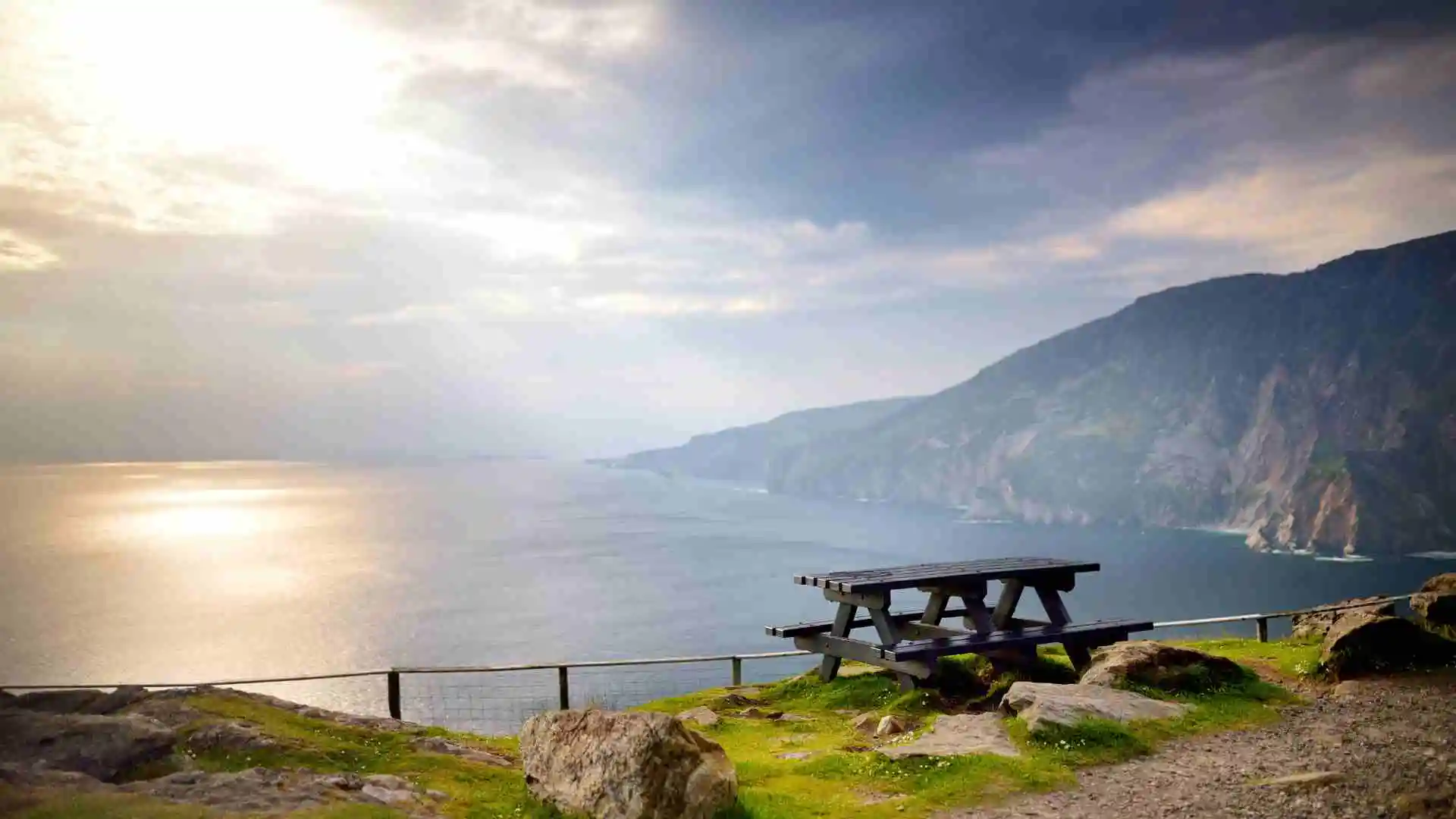
It looks over Carlingford Lough. The plethora of vistas you are treated to during your walk make every twist and turn along the trail a picture-postcard moment.
The trails are well marked and well trodden, but by no means boring. The tracks weave in and out of soft woodlands, across open mountain hair, and through wild heath. If you are looking to do a Carlingford hike, this peak is a must.
How long does it take to climb Slieve Foye?
The time spent climbing it can be both 2 or 4 hours, given the route you take. It also depends on your level of fitness. The shorter straight routes are faster but more strenuous.
Slieve Foye Loop is a longer and less arduous route. In case you are in a rush to have a summit, put aside 2 hours. A complete loop with numerous photo stops will require about 3.5 to 4 hours.
| Route | Time (approx.) | Difficulty |
| Slieve Foye Loop | 3.5–4 hours | Moderate |
| Direct from Carlingford | 2–2.5 hours | Steep / Challenging |
| Táin Way section | 4+ hours | Long / Scenic |
Remember, times can vary with weather conditions and group pace. So always add extra buffer time.

Where to start the Slieve Foye hike
The majority of walkers start their walk directly from Carlingford village. It is easily accessible, well signposted, and laden with wonderful little cafés for a pre-walk coffee.

Another popular entry point is through the Slieve Foye Woods. It is linked to the loop trail. The third entry could be to pick up the Táin Way route. This route runs along the southern flank of the mountain.
Parking options:
- Carlingford village car park – large and central
- Slieve Foye Woods car park – smaller, closer to forest trails
- Harbour car park – scenic but fills quickly on weekends
Make sure to arrive early on sunny days, as spaces fill fast.
Slieve Foye Loop Walk Guide
The loop is the most popular route, with all good reasons. It combines forest trails, steep mountain slopes, and stunning views from the summit into one rewarding loop. Below is a stage-by-stage breakdown to help with your planning.
1. Starting Point in Carlingford
Just outside the tourist office or alongside the village square, the entry point to the Slieve Foye Loop begins. It follows the loop signs through discreet laneways uphill. Shortly after, the village disappears behind you. And the Cooley Mountains come into the view ahead.
2. Into the Woods
You will quickly enter the Slieve Foye Woods. It is a peaceful section filled with mossy trees and birdsong. The forest path climbs gently at first. This is a good place to find your rhythm before the steeper sections arrive.
3. Open Mountain Stretch
The trail emerges from the trees onto rough, open hillside. The gradient sharpens and the wind picks up. Take your time here, and stop often to look back. The sparkling Carlingford Lough spreads out like a silver sheet below you.
4. Reaching the Summit
The final push is steep but short. At the top, you will find a rocky summit marked by a small cairn. On a clear day, you can see the Mourne Mountains across the water, and even the Isle of Man on the horizon.
5. Descent and Return Path
Continue the loop by descending westward, where the gradient eases. The path gradually curves back toward the woods and then down to Carlingford. Many walkers pause here for a picnic before heading into the village for well-earned food.
Tip: The phone signals might drop close to the summit. So, download an offline map of the loop from AllTrails or OutdoorActive before you go
Alternative Routes on Slieve Foye

If you’re after an alternative to the loop, try these routes across the Cooley Mountains.
- A Direct Ascent of Carlingford: A steep climb direct to the summit. It is a no-nonsense way to get up. Takes about 2 hours up and down, which is great for those short on time.
- Táin Way Stage: A long distance trail that crosses the Cooley Mountains. It runs along the flank of Slieve Foye. It is less steep but allow 5-6 hours if you’re doing the summit.
- Variation: Some people walk the loop in reverse or cross mid-way. It makes the walk shorter.
Quick comparison:
- Direct Carlingford – Shortest, steepest
- Táin Way – Longest, scenic and varied
- Loop – Balanced mix of forest and open mountain
What is Slieve Foye known for?
It is the highest mountain in the Cooley Mountains. It measures 589 metres. It is famous with its scenic sceneries along carlingford lough and irish sea. On sunny days you may see the Mourne Mountains. These seem to be projecting like shadows in the north.

There are also its strong connections with Irish folklore. The mountain is said to be the grave of the giant warrior, Fionn mac Cumhaill. It forms part of the epic Tain Bo Cuailnge. Even the locals jokingly say that Leprechauns reside on its slopes. Carlingford is their official residence.
Best Time of Year to Climb Slieve Foye
When planning your hike in Carlingford, seasonal planning is an important area to consider. Spring and summer generally feel like the best season for hiking. They provide longer days, drier ground, and clearer skies.

Autumn can also be beautiful with the golden colours. However, it can provide muddy slopes. Winter storms can create slippery paths and low visibility. Also, you should avoid January and February as potential peak months.

Seasonal tips:
- Spring: Mild weather, fewer crowds
- Summer: Long days, clearest views
- Autumn: Beautiful colours, more rain
- Winter: Only for experienced hikers
Equipment and Safety Tips for Slieve Foye
You don’t need technical gear for the loop. Just some basics to keep you safe and comfortable. Think of it as preparing for any moderate mountain trail.

Checklist:
- Sturdy hiking boots with grip
- Waterproof jacket and warm layers
- Offline map or GPS app
- Snacks and at least 1 litre of water
- Fully charged phone and power bank
- Sunhat and sunscreen in summer
Check the forecast before you leave. If clouds roll in, turn back, navigation can get tricky in fog.
Things to Do After Climbing Slieve Foye
After conquering the peak, spend time exploring the surroundings of Carlingford. This little medieval town is packed with charm.
Ideas:
- Grab fish and chips or a pint in Carlingford village pubs
- Cycle along the scenic Carlingford Greenway
- Take the Carlingford Ferry across to Greencastle
- Wander the ruins of King John’s Castle
- Try a sea kayaking tour on the lough
It is the perfect reward after your mountain adventure. If you loved this hike, you can also check for other hiking trails in Ireland here.


