Kippure summit walk | Why hikers love this Dublin peak
Kippure is a major mountain on the County Dublin and Wicklow border. At 757 metres (2,484 ft), it is the highest point in County Dublin.
As one of the highest peaks on the northern side of the Wicklow Mountains, Kippure is a prominent landmark that can be seen from much of Dublin. This is largely due to the tall radio and television transmitter mast on its summit. The River Liffey and the River Dodder also rise from its broad slopes.
Whether you are a casual walker or an experienced hiker, Kippure offers a rare mix of high altitude scenery and easy access. This makes it one of the most rewarding hikes close to Dublin.
Where Is Kippure Located?
Kippure sits on the northern edge of the Wicklow Mountains National Park and straddles the border between South Dublin and County Wicklow. It is a popular local escape as it lies about 25 kilometres from Dublin city centre.
The mountain is located along the R115, widely known as the Military Road. This historic route offers some of the most scenic mountain views in Ireland. It also passes the nearby Sally Gap, a high mountain pass that links the Liffey Valley with the Glendalough area.
How High Is Kippure?
Kippure stands at 757 metres (2,484 ft). This makes it the highest mountain in County Dublin and one of the higher peaks in the Wicklow Mountains.
The mountain is classified as both a Marilyn and a Hewitt, terms used for peaks with significant prominence. The summit itself is broad rather than steep. Despite its gentle shape, the elevation provides excellent views. On very clear days, it is sometimes possible to see the mountains of Wales across the Irish Sea.
Kippure Hike Overview
Hiking Kippure is generally considered a moderate walk. Unlike many Irish mountains that involve steep rocky paths, the most popular route to the summit follows a straight and well defined service road.
The surrounding terrain consists mainly of blanket bog and heather moorland. Because a paved service road leads to the transmitter mast, hikers can avoid muddy ground. This makes Kippure one of the more reliable hikes in the Wicklow Mountains even after heavy rain.
Starting Point at Military Road
The most common trailhead for Kippure is along the R115 Military Road. A small parking area sits near the gated service road. This spot is often referred to as the Kippure and Tonduff car park or the quarry car park.

You can reach it by driving south from Dublin towards Sally Gap. Around 5 kilometres before the Sally Gap crossroads, you will see a yellow and black barrier on the right side of the road. The access road begins here and the hike starts from this point.
Distance and Duration
The service road route is an out and back walk of roughly 7.2 kilometres (4.5 miles). Most hikers complete the round trip in about 2 to 3 hours. The exact time depends on your pace and how long you spend at the summit.
The gradient is steady and manageable, although it becomes slightly steeper near the upper hairpin bends. While the road surface is paved, the exposed location means strong winds are common and can slow your progress.
What To Expect On The Kippure Walk
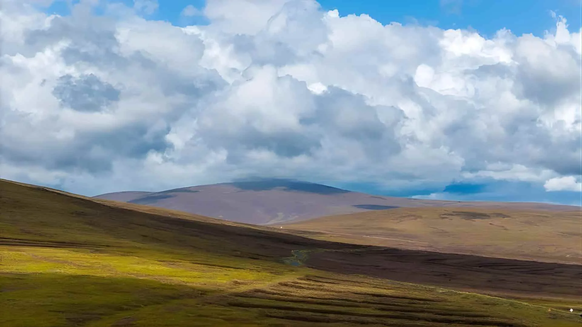
The landscape around Kippure reflects the classic scenery of the Wicklow Mountains. Expect wide stretches of heather, peat bog, and rough mountain ground.
As you climb higher, the large transmitter mast becomes the main landmark ahead. The mast is about 127 metres tall and marks one of Ireland’s earliest television transmission sites. It also acts as a useful navigation point if cloud or mist moves in.
Conditions near the summit are usually colder and windier than at the trailhead. Temperatures can drop quickly, so it is important to prepare for changing weather.
Views From The Kippure Summit
The summit offers wide 360 degree views across eastern Ireland.
To the north, you can see the Dublin skyline, Dublin Bay, and the famous Poolbeg Chimneys. On clear days the coastline stretches far along the Irish Sea.
To the south and east, the Wicklow Mountains extend into the distance. Peaks such as Great Sugar Loaf and Djouce are visible. You can also look down on the dark glacial lakes of Lough Bray Upper and Lower set into the eastern slopes below.
Tips For Hiking Kippure Safely
Although the route is straightforward, you still need to prepare for mountain conditions. Weather in the Wicklow Mountains can change quickly. A clear morning at the car park can turn into thick mist higher up.

Wear sturdy hiking boots with good grip, especially if you plan to leave the road and explore the surrounding ground. Bring waterproof and windproof clothing even in summer. Always tell someone your planned route and expected return time before heading out.
Things To Do Near Kippure
Because the hike is relatively short, many visitors combine it with a scenic drive through the Wicklow Mountains. Sally Gap is only minutes away and offers some of the most photographed landscapes in Ireland.
A 10 minute drive south brings you to Lough Tay, often called Guinness Lake because of its dark water and pale shoreline. The historic monastic site of Glendalough is also nearby and offers several walking trails.
If you prefer an easier walk, the paths around Lough Bray provide impressive cliff side views without the longer climb.
Kippure Adventure Centre
Kippure Adventure Centre sits nearby within the Kippure Estate and offers a range of outdoor activities. The estate covers around 240 acres of private woodland and natural landscape.

Visitors can take part in activities such as high ropes courses, zip lines, and archery. The centre regularly hosts corporate team building events, school trips, and family outdoor experiences in a more structured setting.
Why Kippure Is One Of The Best Hikes Near Dublin
Kippure ranks among the best hikes near Dublin because it combines a true mountain summit with an accessible route. You can stand on the highest point in County Dublin without tackling the steep or technical terrain often found in western Ireland.
Its proximity to the city, the scenic Military Road drive, and the reliable path to the summit make it an ideal day trip. In a short time you can leave the city behind and enjoy sweeping views across Dublin and the Wicklow Mountains, often called the Garden of Ireland.


